TABLEAU
The visualizations above were generate through the Tableau Dashboards we developed below:
This visualization "Monthly ISSR Cell-Hours by ARTCC" Dashboard provides a monthly distribution summary of ISSRs cell counts at pixels for each Air Traffic Control Center (ARTCC). A pixel is a point with (Nx, Ny) cooridnates in the Rapid Refresh (RAP) dataset for June 2020 through May 2021. The radio buttons on the far left of the dashboard provides options to summarize data for a specific month and/or ARTCC.
The histogram on the left "ISSR Cell-Hour Frequency Distribution (at Nx, Ny) Coordinates)" provides a distribution of ISSR cell counts at pixels. The horizontal axis is ISSR cell counts at pixels and the vertical axis is the frequency of pixels (i.e. pixel counts) for corresponding ISSR cell counts.
The table "Average Cell-Hours by Center (ranked)" on the top-right provides mean ISSR cell counts at pixels for each ARTCC, and the bar graph on the bottom-right "Monthly Total ISSR Cell-Hours" provides sum of ISSR cell counts for each month.
The 2nd dashboard below provides a summary of ISSR cell counts, aircraft counts in cells, and aircraft counts in ISSR cells at 6-hour time increments. A cell is a 3-dimensional space corresponding to a grid in the NOAA RAP dataset (represented by a point with Nx, Ny, and pressure level). The radio buttons on the far right of the dashboard provides options to summarize and display data fro a specific month, ARTCC and/or 6-hour UTC time period.
The graphs on the left "6-hour Period ISSR & Planes Cell-Hours (Centerwide)" provides 6-hour totals of ISSR cell counts, aircraft counts in cells, and aircraft counts in ISSR cells. The table on the right ("Totals by ARTCC") provides the totals for each ARTCC.
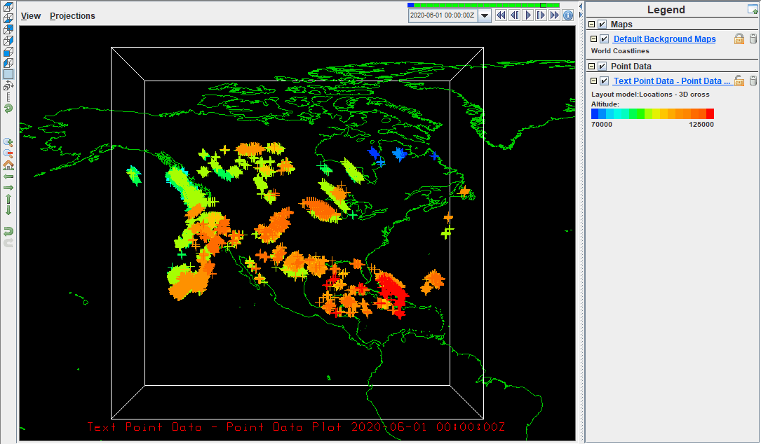
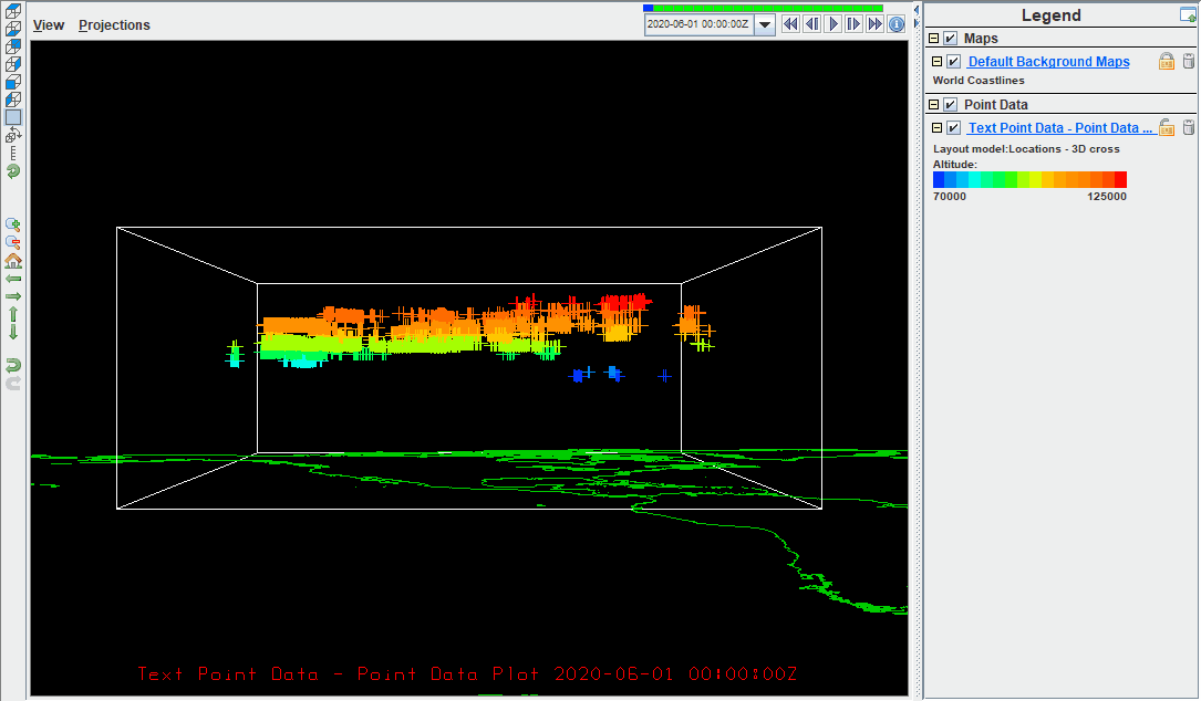
INTEGRATED DATA VIEWER (IDV)
Integrated data viewer (IDV) is a java-based tool that was made specifically for the analysis and visualization of geoscience data.IDV can handle a variety of data formats including gridded data, satellite imagery, surface observations, and radar data. Its interface default is a 3-D rendering of the earth and allows users to create still or animated visualizations over it. To learn more about UCAR's IDV tool click here.
We worked in IDV to show the presence of ISSRs over a 24-hour period. Using our merged dataset, if the value of IsISSR was equal to 1, that spot was represented with a 3-D cross. The shapes were colored by altitude, to show where ISSRs occurred in the airspace over CONUS